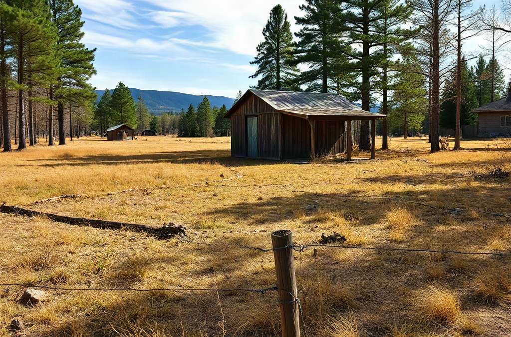
Finding suitable land for homesteading requires screening each parcel for legal use, dependable water, workable soil, safe access, and total development cost before making an offer. Confirm zoning and deed restrictions directly with the relevant offices rather than relying on a listing description. Then examine flood exposure, drainage, well and septic feasibility, road rights, utilities, boundaries, and nearby land uses. A low purchase price can become expensive when a parcel needs a long driveway, extensive grading, power-line extension, or engineered wastewater system.
Define the Homestead Before Searching for Parcels
A useful parcel search begins with an operating plan rather than an acreage target. Five open acres may serve a large garden, orchard, poultry flock, and workshop better than 20 steep or heavily restricted acres. Write down what the property must support during the first three years: a primary residence, temporary dwelling, livestock, food production, equipment storage, home business, or future subdivision. Each intended use creates different requirements for zoning, water, terrain, setbacks, and access.
Separate requirements into nonnegotiable, preferred, and optional criteria. Legal permission for the intended dwelling belongs in the first group. So do year-round road access, an attainable water source, and enough suitable ground for wastewater disposal if no sewer is available. A south-facing garden area, mature trees, or an existing barn may be preferred but should not distract from a parcel that cannot legally or physically support a home.
Set a total project ceiling, not merely a land budget. The calculation should reserve money for closing costs, surveying, driveway construction, clearing, a well or connection fee, septic work, electricity, fencing, drainage improvements, and immediate repairs to existing structures. A cheaper rural tract located far from utilities can cost more to occupy than a higher-priced parcel with a sound driveway, tested well, and approved septic system. Obtain local estimates because rock, slope, hauling distance, permitting, and contractor availability can change costs sharply.
Search geography should reflect daily operations as well. Measure travel time to employment, feed and hardware suppliers, medical services, schools, livestock care, and dependable all-season roads. A remote location may offer privacy, but repeated supply trips and difficult winter access create durable expenses. Use the criteria behind Finding land for homesteading: search criteria and due diligence to reject unsuitable listings early instead of rationalizing them after an attractive showing.
The common failure here is treating acreage and price as the decision. Acreage is only productive when enough of it is accessible, usable, legal, and affordable to improve. A written parcel scorecard keeps scenic views, old barns, or seller promises from outweighing those fundamentals.
Screen Listings for Water, Soil, Terrain, and Access
Desktop screening can eliminate weak parcels before travel and professional inspections. Start with aerial imagery, topographic maps, soil information, flood maps, road records, and the parcel outline supplied by the listing agent or local mapping office. Online boundaries are screening tools, not surveys, but they can reveal possible wetlands, drainage channels, utility corridors, landlocked areas, steep grades, and neighboring operations.
Water deserves separate evaluation for household use, livestock, and irrigation. An existing well should have records showing its construction and location, followed by appropriate yield and water-quality testing during due diligence. For vacant land, ask local well drillers about nearby depths, geology, seasonal limitations, and unsuccessful wells; neighboring performance is useful context but does not guarantee results on the parcel. A creek, spring, or pond should not be counted as a dependable supply until access rights, seasonal flow, treatment needs, and applicable rules have been investigated.
Soil suitability depends on the planned use. Productive garden ground benefits from reasonable depth, drainage, workable texture, and manageable contamination risk. Wastewater suitability is a different question determined through local procedures and site evaluation. Rich-looking topsoil does not prove that the subsoil can accept effluent, while a parcel with modest agricultural soil may still contain a suitable homesite. Request any prior soil, septic, or percolation records, then verify whether they remain valid for the proposed house location and bedroom count.
Walk the land after rain if possible. Standing water, sediment fans, deeply cut channels, leaning fence posts, exposed roots, and water marks on trees or buildings can contradict the impression formed during dry weather. Follow the likely driveway route and note stream crossings, culverts, soft ground, tight turns, overhead clearance, and the grade a delivery truck or emergency vehicle would face.
Legal access is more valuable than a visible track. Determine whether frontage reaches a maintained public road or whether a recorded easement establishes the route, width, allowed uses, and maintenance duties. A shared lane may function well, but vague cost-sharing arrangements can become disputes when gravel, snow removal, gates, or culverts need attention. The mistake to avoid is assuming that long-standing physical use proves an enforceable right of access.
Verify Zoning, Restrictions, and Building Rights
Land-use permission must be confirmed for the specific parcel and intended activities. Contact the planning or zoning office with the parcel number and ask about permitted dwellings, minimum lot size, setbacks, accessory buildings, agricultural uses, animal limits, home occupations, temporary housing, and permit sequencing. Ask for the governing documents or written confirmation when available. A real estate advertisement describing land as agricultural, unrestricted, or buildable is not an approval.
Government rules are only part of the legal screen. Deeds, plats, subdivision declarations, conservation restrictions, utility easements, pipeline corridors, road easements, and homeowners’ association documents may impose additional limits. Restrictions can govern dwelling size, mobile or manufactured homes, livestock, fencing, exterior materials, commercial activity, or the number and placement of structures. Title professionals and qualified local counsel can help identify how recorded documents affect the proposed use.
Parcel dimensions matter alongside total acreage. Setbacks from roads, boundaries, wells, waterways, septic components, and easements can compress a broad-looking tract into a small buildable envelope. Consider a narrow five-acre lot crossed by a power easement with wet ground at the rear: the listed acreage may be accurate, yet the house, replacement septic area, barn, and driveway may compete for the same limited upland space. Sketching these elements on a survey or reliable concept plan exposes conflicts early.
Nearby uses also deserve direct observation. Visit at different times and listen for highway noise, shooting ranges, kennels, industrial activity, or seasonal farm traffic. Look for dust, smoke, odors, nighttime lighting, drainage entering the parcel, and evidence of future development. Agricultural surroundings can support a homestead, but normal field operations may include machinery, livestock odors, spraying, and early working hours.
Tax treatment should be verified rather than inferred from the current bill. Agricultural assessments, conservation classifications, or deferred taxes may carry eligibility rules, rollback liabilities, or reporting duties after a sale or change of use. Confirm the likely post-purchase assessment with the local taxing authority. Strong Finding land for homesteading: search criteria and due diligence separates what is physically possible from what is legally permitted; both must support the plan.
Inspect the Parcel and Price Its Hidden Work
A field visit should test the assumptions created by maps and listing materials. Bring the parcel map, a camera, weather-appropriate footwear, and written permission if the visit is not accompanied. Walk the proposed homesite, garden, septic area, driveway, pasture, and boundary routes rather than touring only the prettiest clearing. Mark questions for licensed or qualified professionals instead of attempting to diagnose wells, structures, wastewater systems, or boundary disputes personally.
Existing improvements can either reduce startup work or transfer deferred maintenance to the buyer. A barn should be assessed for foundation movement, roof failure, unsafe wiring, rot, drainage, and whether its location complies with current plans. Test and document the well rather than accepting clear-looking tap water as proof of quality or adequate yield. Septic records should match the installed system, and an appropriate inspection may reveal access, condition, or usage concerns that are invisible from the surface.
Vacant parcels require a realistic development worksheet. Price the work in the order it must occur: survey and design, permits, clearing, entrance approval, driveway and culverts, earthwork, water, wastewater, power, communications, and construction access. Include uncertainty allowances where bids cannot yet be firm. A rocky ridge may offer drainage and views but demand costly excavation and well drilling; a level lowland parcel may be easier to build on yet require drainage investigation and carry flood exposure.

Use a compact field checklist to keep the inspection disciplined:
- Homesite: slope, drainage, solar exposure, wind exposure, and room for required setbacks.
- Water and wastewater: records, test locations, reserve septic area, and separation between components.
- Access: legal rights, surface condition, grade, culverts, gates, and maintenance responsibility.
- Working ground: usable acreage, soil condition, erosion, fencing, shade, and machinery access.
- External effects: neighboring uses, odors, noise, runoff, utility corridors, and planned development.
Signs the evaluation is working include written answers, mapped constraints, professional estimates, and a narrowing range of likely costs. Signs it is failing include repeated reliance on phrases such as “should be fine,” refusal to provide records, boundaries that no one can locate, or an offer deadline too short for essential testing. Uncertainty is not automatically disqualifying, but it should be resolved, priced into the offer, or treated as a reason to walk away.
Protect the Purchase With Records and Contingencies
An offer should preserve enough time and legal room to investigate the parcel before the buyer becomes fully committed. The appropriate terms vary by location and transaction, so use a knowledgeable real estate professional or attorney to draft and interpret the agreement. Relevant contingencies may address financing, title, survey, legal access, zoning suitability, water testing, septic feasibility, inspections, environmental concerns, appraisal, and the buyer’s intended use.
General inspection language may not cover every land-specific issue or provide enough time for agency responses and contractor visits. State the required investigations clearly and track deadlines from the signed contract. If a septic site evaluation, entrance permit review, or survey cannot be completed within the original period, request an extension before the deadline rather than assuming the contingency remains open.
Organize due diligence in a parcel file containing the deed, title commitment or report, survey or plat, tax information, restrictions, permits, well and septic records, inspection results, maps, estimates, correspondence, and notes from agency calls. Record the office, date, contact, and exact question for verbal information, then seek source documents where possible. This file supports both the purchase decision and later planning.
Resolve discrepancies instead of choosing the most favorable version. If the seller says the lane belongs to the parcel but the title material shows only a narrow easement, investigate the recorded right. If mapping suggests a flood area while the homesite appears dry, confirm the applicable official information and elevation implications. If an old soil approval exists, ask whether it applies to the current parcel configuration and proposed dwelling.
Renegotiation should be tied to evidence. A documented driveway estimate, failed water test, boundary issue, or required engineered system gives the parties a concrete basis for changing price or terms. Some defects can be managed; others undermine the homestead plan. The disciplined outcome of Finding land for homesteading: search criteria and due diligence is not always a purchase. Walking away before closing can be the sound result when access, legal use, water, or development cost remains unacceptable.
Frequently Asked Questions
How many acres are enough for a homestead?
The answer depends on the intended house, food production, livestock, woodlot, and wastewater system. A smaller parcel with usable soil and secure water may outperform a larger tract dominated by steep, wet, inaccessible, or restricted ground.
Should I test the soil before buying rural land?
Yes, but match the test to the decision. Garden soil analysis, contamination screening, and a wastewater site evaluation answer different questions; local requirements determine which professional evaluations are needed.
How can I tell whether vacant land is buildable?
Confirm zoning, setbacks, legal access, utilities or off-grid feasibility, water availability, wastewater approval, flood constraints, easements, and a practical building envelope. No single map or seller statement establishes buildability.
What is the biggest hidden cost when buying homestead land?
Site development often creates the largest surprise. Long driveways, difficult wells, engineered septic systems, utility extensions, grading, drainage work, and construction access can collectively exceed the apparent savings on inexpensive acreage.
Can I rely on online parcel maps to identify boundaries?
Online maps are helpful for initial screening but may not show surveyed boundaries accurately. Use recorded plats, deed information, visible monuments, and a licensed survey when boundary location affects access, improvements, fencing, or the purchase decision.
Conclusion
A sound land purchase is built on verified use, usable ground, dependable access, and a development budget that survives realistic estimates. Define the intended homestead before searching, reject parcels that fail nonnegotiable criteria, and investigate promising properties with records, site visits, agency confirmation, and appropriate professional help. Pay particular attention to legal access, water, wastewater feasibility, setbacks, drainage, title restrictions, and the true buildable envelope. Before signing an offer, identify which questions must be answered and provide sufficient contingencies and time to answer them. The next practical step is to create a parcel scorecard and cost worksheet, then use both consistently at every showing. Attractive acreage remains a poor bargain when unresolved constraints prevent the property from supporting the home and working land you intend to establish.